 Translate
Travel planning by
33
Routes
6
Hubs
ANO
ICAO
TL
IATA
TravelerPulse profile
Connecting the Top End and regional Australia.
Founded
1978
Headquarters
Darwin, Australia
Airnorth is a regional airline based in Darwin, Northern Territory, Australia, operating scheduled passenger and charter services across northern Australia and into Timor-Leste. Founded in 1978, the airline has built a reputation as a key connector for remote and regional communities in the Top End, providing access to destinations that are often underserved by major carriers.
The airline operates a fleet of turboprop and regional jet aircraft, serving routes linking Darwin with towns and cities in the Northern Territory, Western Australia, Queensland, and international routes to Dili, East Timor. Airnorth plays an important role in supporting the resources, government, and tourism sectors across northern Australia.
Airnorth has at various times had codeshare and interline agreements with major Australian and international carriers, enhancing connectivity for passengers traveling through Darwin. The airline is known for its reliable service in challenging remote operating environments.
Hubs & network
Airnorth's primary hub is Darwin International Airport, with key operations also at Gove (Nhulunbuy) and other regional Northern Territory airports.
Fleet
Airnorth operates a fleet that has included Embraer ERJ 170 regional jets and SAAB 340 turboprops for regional and charter services.
Notable facts
- ›Airnorth is one of the longest-serving regional airlines in Australia's Northern Territory.
- ›The airline operates international services between Darwin and Dili, Timor-Leste.
- ›Airnorth supports the resources sector through dedicated charter operations across remote northern Australia.
- ›The airline has held codeshare arrangements with carriers including Virgin Australia.
- ›Airnorth uses the callsign 'TOPEND,' reflecting its geographic focus on Australia's Top End region.
This profile is provided for general information only. Contact details may be inaccurate or outdated — always verify with the airline's official website before acting on them.
Primary hubs
Route network map (33 legs)
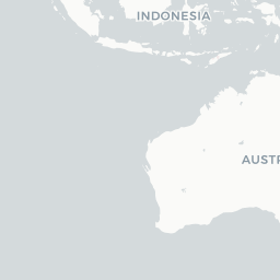

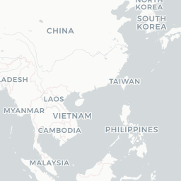






Leaflet © OpenStreetMap © CARTO
Route network
DRW → DILE70
DRW → GTEEM2
DRW → ISAE70
GOV → DRWEM2
ISA → OOLE70
MGT → MNGEM2
MNG → ELCEM2
PER → KNXE70
PHE → BMEE70
BME → KNXE70
BME → KTAE70
DRW → GOVEM2
DRW → KNXE70
DRW → MCVE70
KNX → BMEE70
KNX → DRWE70
KTA → PHEE70
MCV → DRWE70
MNG → DRWEM2
BME → DRWE70
DRW → BMEE70
DRW → MNGEM2
MNG → MGTEM2
TSV → DRWE70
DIL → DRWE70
DRW → TSVE70
ELC → MNGEM2
GOV → GTEEM2
GTE → DRWEM2
GTE → GOVEM2
ISA → DRWE70
KNX → PERE70
OOL → ISAE70
Fleet (aircraft types operated)

Encyclopaedia
Airnorth is a regional airline based at Darwin Airport in Darwin, Northern Territory, Australia. It operates scheduled and charter services in the Northern Territory, Queensland, Western Australia, Timor-Leste and Papua.
Read full article on WikipediaLatest news
Embraer· 2/6/2026
Airnorth strengthens long-term partnership with Embraer through fleet support agreement
Read at Embraer
Australian Aviation· 8/18/2026
Airnorth extends Saturday Kununurra flights to December
Read at Australian Aviation
NT News· 8/20/2026
Cheap fares: Airnorth sale as part of NT network expansion trial
Read at NT News
Bristow Group Inc.· 6/29/2022
Challenges galore, Airnorth is coming back stronger than ever
Read at Bristow Group Inc.
ABC News & Headlines – Australian Broadcasting Corporation· 2/26/2026
High cost of flying leaves Kimberley residents feeling isolated
Read at ABC News & Headlines – Australian Broadcasting Corporation
Australian Aviation· 8/24/2026
Airnorth charter supports SpaceX rocket retrieval
Read at Australian Aviation
