Translate



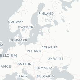
Regional air connectivity across France and Europe.
Founded
2001
Headquarters
Paris, France
Airlinair was a French regional airline that operated scheduled and charter passenger services primarily within France and to neighboring European destinations. The carrier focused on connecting smaller regional cities with major hubs, serving routes that larger carriers typically overlooked.
The airline operated as a franchise partner and was closely associated with Air France's regional network, feeding traffic into the larger carrier's mainline services. Airlinair used the IATA code A5 and operated under the callsign AIRLINAIR.
Airlinair ceased independent operations and was absorbed into HOP!, the Air France regional subsidiary created in 2013 through the merger of several regional carriers including Régional, Brit Air, and Airlinair itself. This consolidation was part of Air France's strategy to streamline its regional operations.
Hubs & network
Airlinair primarily operated from Paris Charles de Gaulle Airport and various French regional airports.
Fleet
Airlinair operated ATR 42 and ATR 72 turboprop aircraft on its regional routes.
Notable facts
- ›Airlinair was a franchise partner of Air France, operating flights under close commercial cooperation with the flag carrier.
- ›The airline was merged into HOP! in 2013 along with Régional and Brit Air as part of Air France's regional consolidation.
- ›Airlinair specialized in thin regional routes connecting smaller French cities to major hubs.
- ›The carrier used the ICAO code RLA and callsign AIRLINAIR.
- ›HOP!, the successor entity, continued serving many of the routes previously operated by Airlinair.
This profile is provided for general information only. Contact details may be inaccurate or outdated — always verify with the airline's official website before acting on them.