AirlinesAirports.com
Powered by Google TranslateTranslate
Travel planning byTravelerPulse.pro
Zarzaitine - In Aménas Airport Regional Airport illustrationRegional Airport
Airports
IAMmedium airport

Zarzaitine - In Aménas Airport

In Aménas, Algeria
Explore In Aménas city guide Navigate to this airport
2
Routes out
2
Destinations
DAUZ
ICAO
1847 ft
Elevation
AirlinesAirports profile

Remote desert gateway serving Algeria's southeastern energy heartland.

Location
In Aménas, Algeria
Zarzaitine - In Aménas Airport (IATA: IAM, ICAO: DAUZ) is a regional airport located near In Aménas, a town in the Illizi Province of southeastern Algeria. It primarily serves the surrounding oil and gas industry, providing air access to workers and personnel operating in one of Algeria's major hydrocarbon production zones. The airport gained international attention in January 2013 following the In Aménas hostage crisis, when militant Islamist attackers targeted the nearby Tigantourine gas facility operated by BP, Statoil, and Sonatrach. The airport played a role in evacuation and response efforts during that crisis. Given its remote Saharan location, the airport has limited commercial passenger services and largely supports energy-sector operations. Air Algérie provides scheduled connections to Algiers and other domestic destinations.
Terminals
The airport has a modest single-terminal facility suited to the limited passenger volumes of a remote regional desert hub.
Getting to & from
Ground transport to In Aménas town is limited, with road transfers being the primary means of reaching the airport from the local area.
Airlines here
Air Algérie is the primary carrier operating scheduled domestic services from In Aménas Airport.
Notable facts
  • ›Located in the Illizi Province of the Sahara Desert in southeastern Algeria.
  • ›Primarily serves oil and gas industry workers in the Zarzaitine–Tigantourine energy region.
  • ›The airport was involved in evacuation efforts during the January 2013 In Aménas hostage crisis.
  • ›Elevation is approximately 1,847 feet (563 meters) above sea level.
  • ›Named after the nearby Zarzaitine oil field, one of Algeria's significant hydrocarbon areas.
This profile is provided for general information only. Details may be inaccurate or outdated — always verify with the airport's official website before acting on them.
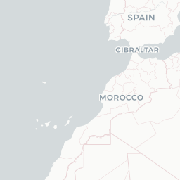
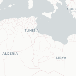
Route map (2 destinations)

Leaflet © OpenStreetMap © CARTO

Airlines serving this airport

Routes

IAM → OGXAH · ATR
IAM → HMEAH · 736
Hotels near IAM

Pick what matters for your layover or early flight, then compare on your favorite booking site.

Compare stays for your dates

AirlinesAirports may receive compensation when you book or purchase through some of the links on this page, at no additional cost to you. Prices and availability are set by the booking provider and may change. We never share your private trip details with partners — only the destination, dates and party size you searched.

City & Place Guide

Desert gateway to Algeria's vast Saharan wilderness

In Aménas (also spelled Ain Amenas) is a remote desert city in southeastern Algeria, situated near the Libyan border in the Illizi Province. It sits at the edge of the Sahara and serves primarily as a hub for the region's significant oil and gas industry, making it one of Algeria's most strategically important energy centers.

Despite its industrial character, the surrounding landscape offers dramatic Saharan scenery, including sweeping sand dunes, rocky plateaus, and ancient geological formations. The city gained international attention in 2013 following a hostage crisis at a nearby gas facility, but it has since remained a functioning, though restricted-access, administrative and energy town.

Travelers who do make it here are typically drawn by the raw, untouched Saharan environment and proximity to the Tassili n'Ajjer UNESCO World Heritage region. Tourism infrastructure is minimal, so independent travelers should be well-prepared and ideally arrange visits through organized Algerian tour operators.

  • •Tassili n'Ajjer National Park — UNESCO World Heritage site with ancient rock art and surreal sandstone formations
  • •Saharan Dune Fields — vast, photogenic dunes offering classic Saharan landscape experiences
  • •Tin Fouyé Area — dramatic rocky desert terrain typical of southeastern Algeria
  • •Local Saharan Oases — small palm-fringed oases providing relief and traditional desert-life glimpses
  • •Illizi Province Plateau — sweeping views of the Algerian Sahara from elevated rocky terrain
  • •In Aménas Market — modest local market offering a glimpse into daily desert-town life

Getting around: In Aménas has a domestic airport (IAM) with flights connecting to Algiers and other Algerian cities, which is the primary way most visitors arrive. Within the city and surrounding desert areas, taxis and hired 4x4 vehicles are the practical options, as there is no public rail service and urban bus networks are very limited. For excursions into the desert, a local guide with a robust four-wheel-drive vehicle is strongly recommended and often essential.

Best time: October through March offers the most bearable temperatures, as summer heat routinely exceeds 45°C (113°F) and makes outdoor exploration dangerous.

Local food: Travelers should try traditional Algerian Saharan staples such as couscous with camel or lamb, Taguella (Tuareg bread baked in sand embers), and sweet mint tea served in the traditional nomadic style.

This guide is provided for general information only. Verify details locally before making travel decisions.

Passport, Visa & Immigration

Flying internationally via IAM? Check entry, transit and customs requirements for Algeria from official government sources.

Entity data from open aviation datasets (OurAirports, OpenFlights) with AI-assisted editorial clearly marked. Always confirm time-sensitive details with the official airport website. Sources & verification