

AirlinesAirports.com
Travel planning byTravelerPulse.pro
Toncontín Airport Coastal & Island Airport illustrationCoastal & Island Airport
Airports
TGUmedium airport

Toncontín Airport

Tegucigalpa, Honduras
Explore Tegucigalpa city guide Navigate to this airport
18
Routes out
11
Destinations
MHTG
ICAO
3294 ft
Elevation
AirlinesAirports profile

Honduras's main gateway, nestled in a challenging mountain valley.

Opened
1934
Location
Tegucigalpa, Honduras
Toncontín International Airport serves as the primary commercial airport for Tegucigalda, the capital of Honduras. Situated in a narrow valley surrounded by mountains, it is widely regarded as one of the most challenging airports in the world for pilots to navigate due to the steep approach required over surrounding terrain. The airport has experienced several serious incidents and accidents over its history, largely attributable to its difficult geography and short runway. These safety concerns led to long-running discussions about constructing a replacement facility. A new international airport, Palmerola International Airport (XPL), opened in 2021 to gradually assume international traffic from Toncontín. Despite the opening of Palmerola, Toncontín has continued to handle some domestic and regional flights. The airport's challenging approach over a densely populated urban area has kept it in the spotlight of aviation safety discussions for decades.
Terminals
The airport operates a single terminal building handling both domestic and international passengers.
Getting to & from
Ground transport from Toncontín to central Tegucigalpa is available via taxis and private shuttles, as the airport is located just a few kilometers from the city center.
Airlines here
Airlines that have operated at Toncontín include Avianca, Copa Airlines, and domestic carriers such as Aerolíneas Sosa.
Notable facts
  • ›Toncontín is frequently listed among the world's most dangerous airports due to its mountainous approach and short runway.
  • ›The runway is approximately 1,889 meters (6,198 feet) long, limiting the size of aircraft that can safely operate there.
  • ›A TACA Airlines flight overran the runway in 2008, killing several people on the ground.
  • ›Palmerola International Airport opened in 2021 as a safer replacement for international flights.
  • ›The airport sits at an elevation of approximately 1,004 meters (3,294 feet) above sea level.
This profile is provided for general information only. Details may be inaccurate or outdated — always verify with the airport's official website before acting on them.
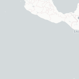
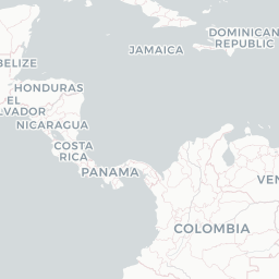
Route map (11 destinations)

Leaflet © OpenStreetMap © CARTO

Routes

TGU → GUA5U · SF3
TGU → MIAAA · 757
TGU → GUAAV · ATR
TGU → SALAV · ATR E90
TGU → SJOAV · ATR
TGU → PTYCM · 738
TGU → PEUCC · SF3
TGU → RTBCC · SF3
TGU → SAPCC · SF3
TGU → SJOCM · E90 73G
TGU → GUACC · L4T
TGU → ATLDL · 73W
TGU → SJOKL · EMJ
TGU → LCEP4 · L4T
TGU → GUAP4 · CRJ
TGU → RTBP4 · L4T
TGU → IAHUA · 73G
TGU → MIAUS · 757
Hotels near TGU

Pick what matters for your layover or early flight, then compare on your favorite booking site.

Compare stays for your dates

AirlinesAirports may receive compensation when you book or purchase through some of the links on this page, at no additional cost to you. Prices and availability are set by the booking provider and may change. We never share your private trip details with partners — only the destination, dates and party size you searched.

City & Place Guide

Mountain capital where colonial history meets Honduran highland culture.

Tegucigalpa, nestled among pine-covered hills at roughly 1,000 meters elevation, is one of Latin America's few capitals without a colonial grid plan, giving it a hilly, winding character unlike most regional cities. Founded by Spanish miners in the 16th century, it retains a compact historic center filled with colorful facades, ornate churches, and bustling markets alongside government buildings and museums.

The city is often overlooked by travelers en route to the Bay Islands or Copán, but its authentic urban energy, walkable downtown, and proximity to cloud-forest reserves make it a rewarding stop. Safety awareness and common urban precautions are advised, as in any large Central American city.

  • •Plaza Morazán — the lively main square anchored by the baroque Cathedral of Saint Michael.
  • •Basílica de Suyapa — national pilgrimage church housing the tiny beloved Virgin of Suyapa.
  • •Parque Nacional La Tigra — cloud-forest reserve just 22 km away, ideal for birding and hiking.
  • •Museo para la Identidad Nacional (MIN) — immersive exhibits on Honduran history including a Maya virtual tour.
  • •Barrio La Leona — hillside neighborhood with a mirador offering sweeping city panoramas.
  • •Mercado San Isidro — bustling traditional market for handicrafts, produce, and local street food.

Getting around: Tegucigalpa has no metro or commuter rail; residents rely on public buses and minibuses called rapiditos that are cheap but crowded. Taxis are widely available and should be negotiated or metered before boarding; always use authorized cabs or call a dispatch service. Uber operates in the city and is generally considered a safer, more transparent option for visitors.

Best time: November through April, the dry season, offers sunny skies and comfortable highland temperatures ideal for sightseeing.

Local food: Try baleadas (flour tortillas stuffed with beans, cheese, and cream), plato típico with grilled meat and tamales, and sopa de caracol for a taste of Honduran culinary tradition.

This guide is provided for general information only. Verify details locally before making travel decisions.

Passport, Visa & Immigration

Flying internationally via TGU? Check entry, transit and customs requirements for Honduras from official government sources.

Toncontín International Airport
Encyclopaedia

Toncontín Airport formerly Toncontín International Airport, also known as Teniente Coronel Hernán Acosta Mejía Airport, is a civil and military airport located 6 kilometres (4 mi) from the centre of Tegucigalpa, Honduras.

Read full article on Wikipedia

Entity data from open aviation datasets (OurAirports, OpenFlights) with AI-assisted editorial clearly marked. Always confirm time-sensitive details with the official airport website. Sources & verification