
AirlinesAirports.com
Powered by Google TranslateTranslate
Travel planning byTravelerPulse.pro
Tulita Airport Mountain Airport illustrationMountain Airport
Airports
ZFNsmall airport

Tulita Airport

Tulita, Canada
Explore Tulita city guide Navigate to this airport
2
Routes out
2
Destinations
CZFN
ICAO
332 ft
Elevation
AirlinesAirports profile

Remote gateway serving Tulita in Canada's Northwest Territories.

Location
Tulita, Canada
Tulita Airport (IATA: ZFN, ICAO: CZFN) is a small regional airport serving the community of Tulita, located in the Sahtu Region of the Northwest Territories, Canada. Tulita sits at the confluence of the Mackenzie and Great Bear rivers, and the airport provides a vital air link for this remote community of roughly 500 residents. The airport supports essential air services including mail, cargo, medical evacuations, and passenger transport, as road access to Tulita is limited and seasonal. It plays a critical role in the community's connectivity to larger centers such as Norman Wells and Yellowknife. The facility features a gravel runway and basic infrastructure typical of remote northern Canadian airports managed under Transport Canada and territorial oversight.
Terminals
The airport has a simple, small terminal building suited to the low passenger volumes of a remote northern community.
Getting to & from
Ground transport within Tulita is limited, with the small community accessible primarily by local roads from the airport.
Airlines here
North-Wright Airways and other small regional carriers have historically provided scheduled and charter services to Tulita.
Notable facts
  • ›Tulita is located at the confluence of the Mackenzie and Great Bear rivers, making air access especially important.
  • ›The airport serves a community of approximately 500 people in the Sahtu Region of the Northwest Territories.
  • ›The runway is gravel-surfaced, typical of remote northern Canadian airports.
  • ›Air travel is the primary year-round means of connection to larger centres, as the road is only a winter ice road.
  • ›The airport supports essential services including medical evacuations and cargo resupply for the community.
This profile is provided for general information only. Details may be inaccurate or outdated — always verify with the airport's official website before acting on them.
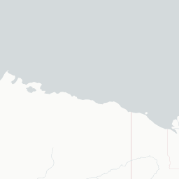

Route map (2 destinations)

Leaflet © OpenStreetMap © CARTO

Airlines serving this airport

Routes

ZFN → YVQHW · DHT
ZFN → YWJHW · DHT
Hotels near ZFN

Pick what matters for your layover or early flight, then compare on your favorite booking site.

Compare stays for your dates

AirlinesAirports may receive compensation when you book or purchase through some of the links on this page, at no additional cost to you. Prices and availability are set by the booking provider and may change. We never share your private trip details with partners — only the destination, dates and party size you searched.

City & Place Guide

Remote Arctic village where rivers meet the wilderness.

Tulita is a small Dene community of roughly 500 people located at the confluence of the Mackenzie and Great Bear rivers in the Northwest Territories of Canada. Surrounded by boreal forest and dramatic river valleys, it sits in one of the most remote and unspoiled regions of North America, offering visitors an authentic glimpse into Indigenous culture and frontier northern life.

The town is governed largely by the Tulita District Land Corporation and the Dene and Métis peoples who have called this land home for thousands of years. Visitors come primarily for wilderness adventures, cultural experiences, and the raw beauty of the Mackenzie River corridor. Tourism infrastructure is minimal, making this a destination best suited for independent, self-sufficient travelers.

  • •Mackenzie and Great Bear River Confluence — stunning natural meeting point of two mighty river systems.
  • •Bear Rock Mountain — sacred Dene landmark with panoramic views over the river valley.
  • •Tulita Community Cultural Centre — learn about Dene history, language, and traditional practices.
  • •Canol Heritage Trail — historic and remote backcountry trail for serious wilderness trekkers.
  • •Great Bear Lake Access — world-class lake trout fishing and pristine subarctic wilderness nearby.
  • •Northern Lights Viewing — spectacular aurora borealis displays from late August through March.

Getting around: There is no road connection to Tulita for most of the year; the primary access is by small charter aircraft from Norman Wells or Yellowknife. A seasonal ice road provides limited winter vehicle access. Within the village, walking is the main mode of transport, as the community is compact. ATVs and snowmobiles are common local conveyances. No taxis or rideshare services operate here.

Best time: Late June through early August offers the warmest temperatures, long daylight hours, and the best conditions for river travel and hiking.

Local food: Try freshly caught Arctic grayling or lake trout prepared in traditional Dene style, and look for locally harvested game such as moose or caribou when visiting during community gatherings.

This guide is provided for general information only. Verify details locally before making travel decisions.

Tulita Airport
Encyclopaedia

Tulita Airport is located adjacent to Tulita, Northwest Territories, Canada. Its hours of operation are Monday to Friday from 9 am to 5 pm. The airport does operate outside of its operational hours when responding to MEDIVAC call out.

Read full article on Wikipedia

Entity data from open aviation datasets (OurAirports, OpenFlights) with AI-assisted editorial clearly marked. Always confirm time-sensitive details with the official airport website. Sources & verification