
AirlinesAirports.com
Travel planning byTravelerPulse.pro
Kinmen Airport Regional Airport illustrationRegional Airport
Airports
KNHmedium airport

Kinmen Airport

Shang-I, Taiwan
Explore Shang-I city guide Navigate to this airport
5
Routes out
4
Destinations
RCBS
ICAO
93 ft
Elevation
AirlinesAirports profile

Gateway to the historic Kinmen Islands off Taiwan's coast.

Opened
1953
Location
Kinmen, Taiwan
Kinmen Airport (IATA: KNH, ICAO: RCBS) serves the Kinmen Islands, an archipelago administered by Taiwan (Republic of China) located just a few kilometers off the coast of Fujian Province, mainland China. The airport is the primary air link connecting the strategically significant islands to Taiwan proper. The airport handles domestic flights primarily to Taipei (Songshan), Taichung, and Chiayi, as well as some cross-strait charter and scheduled services. Due to Kinmen's unique geopolitical position, it has also served as a hub for cross-strait 'mini-links' connecting to Xiamen and other nearby mainland Chinese cities. Kinmen itself is known for its military history, particularly the 1949 Battle of Guningtou and Cold War-era fortifications, making the airport an important gateway for both business travelers and tourists exploring the island's heritage sites, granite tunnels, and sorghum liquor industry.
Terminals
The airport operates a single passenger terminal handling both domestic and limited cross-strait international services.
Getting to & from
Passengers can access the main Jincheng township and other parts of Kinmen Island via public buses, taxis, and rental vehicles available at the airport.
Airlines here
Uni Air and Mandarin Airlines are the primary carriers operating scheduled domestic routes from Kinmen Airport.
Notable facts
  • ›Kinmen Airport sits close to the Chinese mainland, with Xiamen visible on clear days across the strait.
  • ›The airport has served cross-strait 'mini-link' routes connecting Taiwan and mainland China since the early 2000s.
  • ›Kinmen Island is famous for its sorghum-based Kaoliang liquor, drawing significant tourism through the airport.
  • ›The runway was originally constructed for military use during the Republic of China Armed Forces' defense of the islands.
  • ›IATA code KNH reflects the historical romanization of the island group's name.
This profile is provided for general information only. Details may be inaccurate or outdated — always verify with the airport's official website before acting on them.

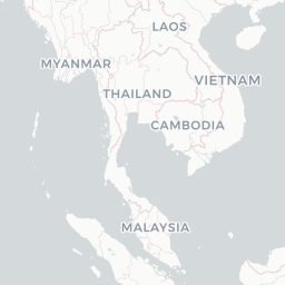
Route map (4 destinations)

Leaflet © OpenStreetMap © CARTO

Airlines serving this airport

Routes

KNH → RMQAE · E90
KNH → TSAAE · E90
KNH → TSAGE · AT7
KNH → KHHGE · AT7
KNH → MZGGE · AT7
Hotels near KNH

Pick what matters for your layover or early flight, then compare on your favorite booking site.

Compare stays for your dates

AirlinesAirports may receive compensation when you book or purchase through some of the links on this page, at no additional cost to you. Prices and availability are set by the booking provider and may change. We never share your private trip details with partners — only the destination, dates and party size you searched.

City & Place Guide

Serene mountain township where tradition and nature quietly coexist.

Shangyi (上義) is a quiet rural township in Chiayi County, tucked into the foothills of central-southern Taiwan. It is a place largely off the international tourist radar, offering an authentic glimpse into agricultural Taiwanese life surrounded by rolling tea fields, bamboo groves, and small temples.

The township draws visitors seeking peaceful countryside scenery, hiking trails through forested hillsides, and a slower pace of life. Local farming communities maintain traditional customs, and the area provides a genuine contrast to Taiwan's bustling urban centers.

Access to nearby Alishan National Scenic Area makes Shangyi a convenient base for travelers exploring the greater Chiayi mountain region, adding practical value alongside its quiet rural charm.

  • •Nearby Alishan Forest — legendary sunrise views and ancient cypress trails just a short drive away.
  • •Local Earth God Temples — small neighborhood shrines reflecting deeply rooted Taiwanese folk religion.
  • •Tea Plantation Hillsides — scenic rows of tea bushes ideal for a peaceful countryside walk.
  • •Bamboo Grove Paths — shaded natural corridors popular with locals for morning strolls.
  • •Chiayi City Day Trip — vibrant market culture and the famous Chiayi turkey rice within easy reach.
  • •Rural Fruit Orchards — seasonal guava, mango, and citrus farms welcoming casual visitors.

Getting around: Public transportation in Shangyi is limited; the most practical option is renting a scooter or car in Chiayi City, which is the main transport hub. Local buses run infrequently and may not reach smaller villages. Taxis are available but scarce outside central Chiayi. Rideshare apps like Uber have limited coverage in this rural area, so self-driving or joining a guided tour is strongly recommended.

Best time: October through March offers the most comfortable temperatures, clear skies, and ideal conditions for hiking and exploring the surrounding mountain landscape.

Local food: Try Chiayi-style turkey rice (火雞肉飯), mountain vegetable dishes sourced from nearby farms, sweet potato snacks, and locally grown oolong tea brewed fresh by hillside vendors.

This guide is provided for general information only. Verify details locally before making travel decisions.

Passport, Visa & Immigration

Flying internationally via KNH? Check entry, transit and customs requirements for Taiwan from official government sources.

Kinmen Airport
Encyclopaedia

Kinmen Airport, commonly known as the Shangyi Airport, is a civilian airport serving Kinmen, Fuchien Province, Taiwan. It is located at Jinhu Township of Kinmen County. It was authorized to become a C-class airport under the direct supervision of the Civil Aviation Administration, Ministry of Transportation and Communications of the Executive Yuan. It serves an average of 1.2 million passengers every year.

Read full article on Wikipedia

Entity data from open aviation datasets (OurAirports, OpenFlights) with AI-assisted editorial clearly marked. Always confirm time-sensitive details with the official airport website. Sources & verification