
AirlinesAirports.com
Powered by Google TranslateTranslate
Travel planning byTravelerPulse.pro
Dong Tac Airport Coastal & Island Airport illustrationCoastal & Island Airport
Airports
TBBmedium airport

Dong Tac Airport

Tuy Hoa, Vietnam
Explore Tuy Hoa city guide Navigate to this airport
2
Routes out
2
Destinations
VVTH
ICAO
20 ft
Elevation
AirlinesAirports profile

Central Vietnam's coastal gateway serving Phu Yen Province.

Location
Tuy Hoa, Vietnam
Dong Tac Airport, designated by IATA code TBB and ICAO code VVTH, serves the city of Tuy Hoa in Phu Yen Province, central Vietnam. It handles domestic passenger traffic connecting this coastal region to major Vietnamese cities such as Hanoi and Ho Chi Minh City. The airport occupies a site near the coast and operates as a relatively small regional facility. It supports both civil aviation and has historical roots as a military airfield used during the Vietnam War era. Passenger volumes remain modest compared to major Vietnamese hubs, reflecting the regional nature of Tuy Hoa's economy and tourism base, though the area's beaches and natural attractions draw increasing visitor interest.
Terminals
The airport operates a single terminal building handling domestic arrivals and departures.
Getting to & from
Taxis and private vehicles are the primary ground transport options connecting the airport to central Tuy Hoa city, located a short distance away.
Airlines here
Vietnam Airlines and VietJet Air provide domestic services connecting Tuy Hoa to Hanoi and Ho Chi Minh City.
Notable facts
  • ›The airport is also known historically as Dong Tac, a former military airfield used during the Vietnam War.
  • ›It is one of the smaller regional airports operated under the Airports Corporation of Vietnam (ACV) network.
  • ›The airport serves Phu Yen Province, a region known for its scenic coastline and Vung Ro Bay.
  • ›Runway capacity limits the airport to domestic routes only, with no international scheduled services.
  • ›Phu Yen Province's growing tourism has prompted discussions about expanding airport infrastructure.
This profile is provided for general information only. Details may be inaccurate or outdated — always verify with the airport's official website before acting on them.
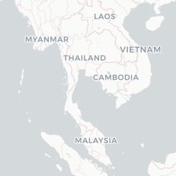

Route map (2 destinations)

Leaflet © OpenStreetMap © CARTO

Airlines serving this airport

Routes

TBB → HANVN · AT7
TBB → SGNVN · AT7

Aircraft operating here

Hotels near TBB

Pick what matters for your layover or early flight, then compare on your favorite booking site.

Compare stays for your dates

AirlinesAirports may receive compensation when you book or purchase through some of the links on this page, at no additional cost to you. Prices and availability are set by the booking provider and may change. We never share your private trip details with partners — only the destination, dates and party size you searched.

City & Place Guide

Unspoiled beaches, ancient towers, and authentic Vietnamese coastal life.

Tuy Hoa is the quiet capital of Phu Yen Province on Vietnam's south-central coast, often overlooked by travelers rushing between Da Nang and Nha Trang. That anonymity is its greatest asset — wide sandy beaches, clear water, and a relaxed pace that feels genuinely local rather than tourist-polished.

The city sits at the mouth of the Da Rang River, flanked by dramatic rocky headlands and rice paddies that tumble toward the sea. Landmarks like the Cham tower of Nhan Mountain and the photogenic Dai Lanh lighthouse reward those who venture slightly beyond the shoreline. Phu Yen gained wider fame as the filming location for the beloved Vietnamese film 'Yellow Flowers on the Green Grass,' drawing domestic visitors who come to see its golden rice fields and honeysuckle landscapes.

  • •Bai Mon – Mui Dien Cape — Vietnam's easternmost mainland point with a historic lighthouse and sweeping sea views.
  • •Thap Nhan Cham Tower — well-preserved 12th-century Cham tower perched on a hill with panoramic city views.
  • •Long Beach (Bai Truong) — long, uncrowded stretch of sand ideal for swimming and sunrise watching.
  • •Da Rang River Mouth — scenic estuary perfect for boat rides and fresh seafood at riverside stalls.
  • •Vung Ro Bay — sheltered emerald bay with wartime history and excellent snorkeling near Mui Dien.
  • •O Loan Lagoon — serene coastal lagoon renowned for fresh oysters and peaceful kayaking.

Getting around: Tuy Hoa has a small but well-connected train station on the main Hanoi–Ho Chi Minh City rail line, making rail the easiest long-distance option. Within the city, Grab (ride-hailing) works reliably, while xe om (motorbike taxis) and metered taxis are plentiful and inexpensive. Renting a motorbike is the best way to reach outlying beaches, the cape, and O Loan Lagoon independently.

Best time: Visit between January and August for sunny skies and calm seas, as Phu Yen is hit by typhoons and heavy rain from September through December.

Local food: Don't miss banh hoi long heo (steamed rice noodles with pork organs), fresh O Loan oysters grilled with scallion oil, and ca ngua (horse mackerel) dishes that showcase the province's exceptional seafood.

This guide is provided for general information only. Verify details locally before making travel decisions.

Passport, Visa & Immigration

Flying internationally via TBB? Check entry, transit and customs requirements for Vietnam from official government sources.

Encyclopaedia

Tuy Hoa Airport is located at Phú Yên ward, just south of former Tuy Hòa city within the Đắk Lắk province, along the central coast of southern Vietnam.

Read full article on Wikipedia

Entity data from open aviation datasets (OurAirports, OpenFlights) with AI-assisted editorial clearly marked. Always confirm time-sensitive details with the official airport website. Sources & verification