

AirlinesAirports.com
Powered by Google TranslateTranslate
Travel planning byTravelerPulse.pro
The Pas Airport Mountain Airport illustrationMountain Airport
Airports
YQDmedium airport

The Pas Airport

The Pas, Canada
Explore The Pas city guide Navigate to this airport
5
Routes out
3
Destinations
CYQD
ICAO
887 ft
Elevation
AirlinesAirports profile

Northern Manitoba's gateway serving The Pas region.

Location
The Pas, Canada
The Pas Airport (IATA: YQD, ICAO: CYQD) is a regional airport serving The Pas, a town in northern Manitoba, Canada. It provides essential air connectivity for a community that relies heavily on aviation due to limited road and rail accessibility to major urban centres. The airport supports scheduled passenger services, cargo operations, and charter flights, playing a vital role in the local economy and for resource industries in the region. It is operated under Transport Canada regulations and serves as a key hub for northern Manitoba air travel. The surrounding area includes significant Indigenous communities and resource extraction industries, making the airport an important link for workers, residents, and essential supplies reaching this remote part of the province.
Terminals
The airport has a small single terminal building suited to the low passenger volumes typical of a regional northern Manitoba facility.
Getting to & from
Ground transport to the town of The Pas is primarily by private vehicle or taxi, as the airport is located a short distance from the town centre.
Airlines here
Calm Air has historically provided scheduled service to The Pas Airport, connecting it to Winnipeg and other northern Manitoba communities.
Notable facts
  • ›The Pas is one of the larger communities in northern Manitoba, making YQD an important regional airport.
  • ›The airport supports medevac and emergency medical flights serving surrounding remote communities.
  • ›Calm Air, a regional carrier specializing in northern Manitoba routes, has been a key operator at the airport.
  • ›The airport serves as a logistical base for resource industries including forestry and mining in the region.
  • ›The Pas Airport has a single paved runway capable of handling turboprop regional aircraft.
This profile is provided for general information only. Details may be inaccurate or outdated — always verify with the airport's official website before acting on them.
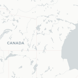
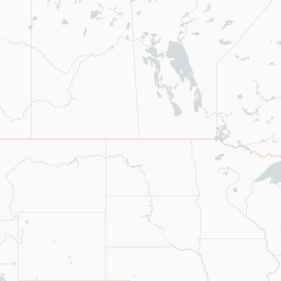
Route map (3 destinations)

Leaflet © OpenStreetMap © CARTO

Routes

YQD → YFOJV · SWM
YQD → YWGJV · SWM
YQD → YFOMO · AT4
YQD → YTHMO · FRJ
YQD → YWGMO · AT4 FRJ
Hotels near YQD

Pick what matters for your layover or early flight, then compare on your favorite booking site.

Compare stays for your dates

AirlinesAirports may receive compensation when you book or purchase through some of the links on this page, at no additional cost to you. Prices and availability are set by the booking provider and may change. We never share your private trip details with partners — only the destination, dates and party size you searched.

City & Place Guide

Gateway to Northern Manitoba's Wilderness, Culture, and Adventure

The Pas is a small northern Manitoba town situated at the confluence of the Saskatchewan River and Pasquia Hills, about 600 kilometres northwest of Winnipeg. With a rich Indigenous heritage rooted in the Opaskwayak Cree Nation, the town blends First Nations culture with a frontier spirit shaped by fur-trade history and resource industries.

Outdoor enthusiasts flock here for world-class fishing, hunting, snowmobiling, and wildlife viewing in the surrounding boreal forest and wetlands. The area is also a launching point for remote northern destinations, making it a practical and culturally rewarding stop for adventurous travelers.

  • •Clearwater Lake Provincial Park — crystal-clear lake ideal for swimming, boating, and camping
  • •Opaskwayak Cree Nation Trappers Festival — celebrated winter carnival featuring dog sled races and traditional contests
  • •Sam Waller Museum — eclectic collection showcasing northern natural history and local artifacts
  • •The Pas Heritage Park — outdoor exhibits on the region's fur-trade and pioneer past
  • •Sacred Heart Cathedral — historic church reflecting the town's early missionary settlement
  • •Saskatchewan River — prime spot for pickerel and northern pike fishing year-round

Getting around: The Pas is served by Via Rail's The Canadian transcontinental route, offering a scenic and practical arrival option. Greyhound-affiliated regional bus services connect the town to Winnipeg and other Manitoba centres. Within town, taxis are available but limited; rideshare apps have minimal coverage, so renting a car is strongly recommended for exploring surrounding parks and attractions.

Best time: Visit in late June through August for warm weather, long daylight hours, and full access to lakes and trails, or in February for the iconic Trappers Festival winter celebration.

Local food: Try freshly caught pickerel prepared in local diners, traditional Cree bannock, and wild game dishes like moose stew available at community events and some local restaurants.

This guide is provided for general information only. Verify details locally before making travel decisions.

Passport, Visa & Immigration

Flying internationally via YQD? Check entry, transit and customs requirements for Canada from official government sources.

Encyclopaedia

The Pas Airport is located 10 nautical miles northeast of The Pas, Manitoba, Canada, near the southern shore of Clearwater Lake.

Read full article on Wikipedia

Entity data from open aviation datasets (OurAirports, OpenFlights) with AI-assisted editorial clearly marked. Always confirm time-sensitive details with the official airport website. Sources & verification