
AirlinesAirports.com
Powered by Google TranslateTranslate
Travel planning byTravelerPulse.pro
Cranbrook/Canadian Rockies International Airport Mountain Airport illustrationMountain Airport
Airports
YXCmedium airport

Cranbrook/Canadian Rockies International Airport

Cranbrook, Canada
Explore Cranbrook city guide Navigate to this airport
4
Routes out
3
Destinations
CYXC
ICAO
3082 ft
Elevation
AirlinesAirports profile

Gateway to the Canadian Rockies in southeastern British Columbia.

Location
Cranbrook, Canada
Cranbrook/Canadian Rockies International Airport (IATA: YXC, ICAO: CYXC) is a regional airport serving Cranbrook, British Columbia, Canada, and the surrounding East Kootenay region. It provides essential air connections for residents, tourists, and the resource industries of southeastern British Columbia. The airport serves as a key access point for visitors to the Canadian Rockies, Kootenay National Park, and popular ski resorts such as Fernie Alpine Resort and Kimberley Alpine Resort. It handles scheduled passenger service as well as general aviation and charter flights. Managed under Transport Canada's National Airports System historically, the airport has undergone infrastructure improvements over the years to accommodate growing regional demand and to support its designation as an international airport of entry.
Terminals
The airport has a single terminal building handling all passenger check-in, arrivals, and departures.
Getting to & from
Ground transportation options include rental cars, taxis, and shuttle services connecting the airport to downtown Cranbrook and surrounding communities.
Airlines here
Air Canada Express (operated by Jazz Aviation) has provided scheduled service connecting Cranbrook to major hubs such as Vancouver and Calgary.
Notable facts
  • ›The airport's full name references the Canadian Rockies to reflect its role as a tourism gateway.
  • ›It is designated as a port of entry into Canada, allowing international arrivals.
  • ›Fernie Alpine Resort and Kimberley Alpine Resort are among the major ski destinations accessible from the airport.
  • ›The airport is located approximately 5 kilometres northwest of downtown Cranbrook.
  • ›Elevation is approximately 2,898 feet (883 metres) above sea level.
This profile is provided for general information only. Details may be inaccurate or outdated — always verify with the airport's official website before acting on them.
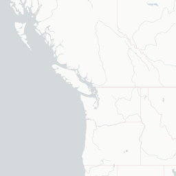
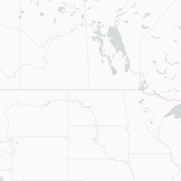
Route map (3 destinations)

Leaflet © OpenStreetMap © CARTO

Airlines serving this airport

Routes

YXC → YLW8P · BE1
YXC → YVR8P · BE1
YXC → YVRAC · DH3
YXC → YYCAC · BEH
Hotels near YXC

Pick what matters for your layover or early flight, then compare on your favorite booking site.

Compare stays for your dates

AirlinesAirports may receive compensation when you book or purchase through some of the links on this page, at no additional cost to you. Prices and availability are set by the booking provider and may change. We never share your private trip details with partners — only the destination, dates and party size you searched.

City & Place Guide

Gateway to the Canadian Rockies in southeastern British Columbia.

Cranbrook is the largest city in the East Kootenay region of British Columbia, nestled between the Rocky and Purcell mountain ranges. With a population of around 20,000, it serves as a regional hub for commerce, healthcare, and outdoor recreation, drawing visitors year-round with its scenic surroundings and friendly small-city atmosphere.

The city blends a rich railway heritage with easy access to world-class skiing, hiking, fishing, and wildlife watching. Nearby attractions include the Rockies, hot springs, and several provincial parks, making Cranbrook an ideal base for exploring southeastern BC.

  • •Canadian Museum of Rail Travel — impressive collection of restored vintage passenger rail cars.
  • •Elizabeth Lake Bird Sanctuary — peaceful urban wetland with diverse migratory birdlife.
  • •Fort Steele Heritage Town — living history village recreating an 1890s BC boomtown.
  • •Kimberley Alpine Resort — nearby ski hill with excellent runs and a charming Bavarian-themed village.
  • •Cranbrook History Centre — local artifacts and exhibits tracing the region's Indigenous and settler past.
  • •Jim Smith Lake Provincial Park — scenic lake ideal for swimming, paddling, and camping.

Getting around: Cranbrook has no urban transit system, so a rental car is the most practical option for getting around and exploring nearby attractions. Taxis and app-based rideshares provide limited local service, and the Canadian Rockies International Airport offers connections to major BC cities.

Best time: Summer (June–August) offers warm weather and peak access to outdoor activities, while winter (December–March) is ideal for skiers targeting nearby Kimberley and Fernie resorts.

Local food: Try hearty mountain fare at local diners, fresh-caught trout from the Kootenay region, and craft beers from area breweries that celebrate BC's outdoor culture.

This guide is provided for general information only. Verify details locally before making travel decisions.

Passport, Visa & Immigration

Flying internationally via YXC? Check entry, transit and customs requirements for Canada from official government sources.

Cranbrook/Canadian Rockies International Airport
Encyclopaedia

Cranbrook/Canadian Rockies International Airport is an airport in British Columbia, located 5 nautical miles north of Cranbrook and 20 km (12 mi) south-east of Kimberley, in the Canadian Rockies.

Read full article on Wikipedia

Entity data from open aviation datasets (OurAirports, OpenFlights) with AI-assisted editorial clearly marked. Always confirm time-sensitive details with the official airport website. Sources & verification