
AirlinesAirports.com
Travel planning byTravelerPulse.pro
Antonio Roldán Betancur Airport Coastal & Island Airport illustrationCoastal & Island Airport
Airports
APOmedium airport

Antonio Roldán Betancur Airport

Carepa, Colombia
Explore Carepa city guide Navigate to this airport
4
Routes out
2
Destinations
SKLC
ICAO
46 ft
Elevation
AirlinesAirports profile

Regional gateway serving the Urabá banana-growing region of Colombia.

Location
Carepa, Colombia
Antonio Roldán Betancur Airport is a regional airport located in Carepa, in the Urabá subregion of Antioquia department, Colombia. It serves as the primary air access point for the banana-producing Urabá Gulf area, connecting the region to major Colombian cities. The airport is named after Antonio Roldán Betancur, a former Governor of Antioquia who was assassinated in 1989. It handles domestic flights and plays an important logistical role for an agriculturally significant region that has historically also been affected by conflict. The facility is administered by the Aeronáutica Civil of Colombia and primarily serves light commercial and cargo traffic, given the relatively small population base of the surrounding municipalities.
Terminals
The airport has a modest single terminal facility suited to regional passenger volumes and domestic operations.
Getting to & from
Ground transport from the airport into Carepa and neighboring Urabá towns is primarily by taxi and private vehicle, as no formal public transit network serves the airport.
Airlines here
Airlines such as Satena and other regional Colombian carriers have historically operated routes connecting Carepa to Medellín and other domestic destinations.
Notable facts
  • ›Named after Antioquia Governor Antonio Roldán Betancur, who was killed in a 1989 car bombing.
  • ›Located in the Urabá region, one of Colombia's most important banana export zones.
  • ›Operates under IATA code APO and ICAO code SKLC.
  • ›Administered by Colombia's civil aviation authority, Aeronáutica Civil.
  • ›The Urabá region's complex security history has influenced the airport's operational profile over the decades.
This profile is provided for general information only. Details may be inaccurate or outdated — always verify with the airport's official website before acting on them.
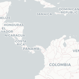
Route map (2 destinations)

Leaflet © OpenStreetMap © CARTO

Routes

APO → EOH9R · AT7
APO → BOG9R · ER4
APO → EOHAV · AT5 AT7
APO → EOHLA · DH2
Hotels near APO

Pick what matters for your layover or early flight, then compare on your favorite booking site.

Compare stays for your dates

AirlinesAirports may receive compensation when you book or purchase through some of the links on this page, at no additional cost to you. Prices and availability are set by the booking provider and may change. We never share your private trip details with partners — only the destination, dates and party size you searched.

City & Place Guide

Gateway to Urabá's lush banana heartland and Caribbean coast

Carepa is a small but lively municipality in the Urabá region of Antioquia, Colombia, situated amid vast banana and plantain plantations that define the local economy and landscape. The town serves as a practical hub for travelers exploring the Gulf of Urabá, with a warm tropical climate and a friendly, working-class character that offers an authentic slice of Colombian regional life.

While not a traditional tourist destination, Carepa rewards curious travelers with its proximity to natural reserves, the nearby coast, and a vibrant market culture rooted in Afro-Colombian and mestizo traditions. It is also a convenient stop on routes connecting Medellín to the Caribbean lowlands.

  • •Plaza Principal — the shaded central square and social heart of town
  • •Banana Plantations — guided walks through industrial-scale fruit farms
  • •Río Carepa — a local river good for cooling off and birdwatching
  • •Urabá Gulf Coast — short drive to beaches and mangroves on the Caribbean
  • •Municipal Market — colorful daily market packed with tropical produce
  • •Turbo (nearby) — port city offering boat trips and Gulf of Urabá access

Getting around: Carepa is best navigated on foot in the center, while mototaxis (motorcycle taxis) are the most common and affordable way to reach outlying areas. Shared minivans and buses connect Carepa to Medellín, Turbo, and other regional towns from the main bus terminal. Traditional taxis are available but less prevalent than mototaxis.

Best time: The driest and most comfortable months to visit are January through March and again in July through August, avoiding the heaviest tropical rains.

Local food: Try sancocho de gallina (hen stew), fried fish with patacones (fried green plantains), and fresh tropical fruits like guanábana and maracuyá sold throughout local markets.

This guide is provided for general information only. Verify details locally before making travel decisions.

Passport, Visa & Immigration

Flying internationally via APO? Check entry, transit and customs requirements for Colombia from official government sources.

Antonio Roldán Betancur Airport
Encyclopaedia

Antonio Roldán Betancur Airport is an airport serving Apartadó, a town in the Antioquia Department of Colombia. The airport is in the countryside 12 kilometres (7.5 mi) southwest of Apartadó. It is named after Antonio Roldán Betancur, who was governor of Antioquia from 1988 until his assassination in 1989.

Read full article on Wikipedia

Entity data from open aviation datasets (OurAirports, OpenFlights) with AI-assisted editorial clearly marked. Always confirm time-sensitive details with the official airport website. Sources & verification