AirlinesAirports.com
Travel planning byTravelerPulse.pro
Carriel Sur International Airport International Hub illustrationInternational Hub
Airports
CCPlarge airport

Carriel Sur International Airport

Concepcion, Chile
Explore Concepcion city guide Navigate to this airport
6
Routes out
4
Destinations
SCIE
ICAO
26 ft
Elevation
AirlinesAirports profile

Gateway to Chile's second-largest metropolitan region.

Opened
1950
Location
Concepción, Chile
Carriel Sur International Airport (IATA: CCP, ICAO: SCIE) serves Concepción, the capital of the Biobío Region and the center of Chile's second-largest urban agglomeration. The airport is located in the Talcahuano commune, just a few kilometers northwest of Concepción's city center, on the shores of Concepción Bay. The airport handles a significant volume of domestic traffic connecting Concepción to Santiago and other Chilean cities, as well as limited international operations. It serves as an important transportation hub for the broader Biobío Region, supporting both business and leisure travel. The facility is operated under the Chilean airport system overseen by the Dirección General de Aeronáutica Civil (DGAC). It has undergone modernization efforts over the years to meet growing passenger demand in the region.
Terminals
The airport operates a single passenger terminal handling both domestic and international flights.
Getting to & from
The airport is accessible by taxi, bus, and rental car services connecting it to Concepción city center and surrounding communities.
Airlines here
LATAM Airlines and Sky Airline are the primary carriers operating at Carriel Sur, offering domestic routes primarily to Santiago.
Notable facts
  • ›Located in the Talcahuano commune, approximately 7 km from Concepción city center.
  • ›The airport is named after the Carriel Sur hill near which it is situated.
  • ›It is one of the busiest airports in Chile outside of the Santiago metropolitan area.
  • ›The airport sustained damage during the 2010 Chile earthquake and tsunami but resumed operations.
  • ›DGAC, Chile's civil aviation authority, administers and oversees airport operations.
This profile is provided for general information only. Details may be inaccurate or outdated — always verify with the airport's official website before acting on them.

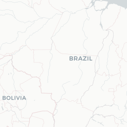
Route map (4 destinations)

Leaflet © OpenStreetMap © CARTO

Routes

CCP → SCL5P · 737
CCP → ZCOH2 · 319
CCP → SCLH2 · 319 320
CCP → ZALH2 · 319
CCP → PMCH2 · 319 320
CCP → SCLLA · 320 319
Hotels near CCP

Pick what matters for your layover or early flight, then compare on your favorite booking site.

Compare stays for your dates

AirlinesAirports may receive compensation when you book or purchase through some of the links on this page, at no additional cost to you. Prices and availability are set by the booking provider and may change. We never share your private trip details with partners — only the destination, dates and party size you searched.

City & Place Guide

Chile's cultural heartland where rivers, art, and student energy meet.

Concepción, capital of the Biobío Region, is Chile's second-largest metropolitan area and a dynamic university city perched between the Biobío River and the Pacific coast. Founded in 1550 and rebuilt multiple times after earthquakes and floods, it carries a resilient, creative spirit reflected in its murals, music scene, and thriving café culture.

The city blends industrial heritage with bohemian neighborhoods like Barrio Universitario, home to the Universidad de Concepción — one of Chile's most prestigious institutions. Nearby Talcahuano offers naval history, while the coastal town of Tomé and the fishing village of Dichato are easy day trips for those craving ocean air.

  • •Universidad de Concepción Campus — stunning murals by Jorge González Camarena anchor a beautiful open campus
  • •Galería de la Historia — panoramic dioramas tracing the history of Concepción and the Biobío Region
  • •Cerro Caracol — forested hill with hiking trails and sweeping city views
  • •Huáscar Monitor — historic Peruvian warship captured by Chile, moored in Talcahuano
  • •Parque Ecuador — leafy linear park perfect for strolling through the city center
  • •Barrio Estación — revitalized arts district with galleries, craft beer bars, and live music venues

Getting around: Concepción has an extensive Biotrén commuter rail linking the city to nearby towns including Talcahuano and Coronel. City buses (Transporte Público Metropolitano) cover most neighborhoods affordably. Taxis and app-based rideshares like Cabify and inDriver operate reliably throughout the metro area. Walking is practical in the compact downtown core.

Best time: Spring (October–November) and early autumn (March–April) offer mild temperatures and lower rainfall, making them the most comfortable seasons to explore the city.

Local food: Try cazuela de vacuno (beef stew), fresh locally caught reineta fish, completos (Chilean-style hot dogs), and regional craft beers from the thriving Concepción microbrewery scene.

This guide is provided for general information only. Verify details locally before making travel decisions.

Passport, Visa & Immigration

Flying internationally via CCP? Check entry, transit and customs requirements for Chile from official government sources.

Carriel Sur International Airport
Encyclopaedia

Carriel Sur International Airport is located in Talcahuano, Greater Concepción in the Bío Bío Region, 8 km (5 mi) from Concepción downtown. It is one of the largest airports in Chile and serves domestic traffic for LATAM Airlines, JetSmart and Sky Airline. It also serves as a primary alternate airport for Arturo Merino Benitez Airport, usually receiving international traffic from Santiago when that airport closes due to weather.

Read full article on Wikipedia

Entity data from open aviation datasets (OurAirports, OpenFlights) with AI-assisted editorial clearly marked. Always confirm time-sensitive details with the official airport website. Sources & verification