

AirlinesAirports.com
Powered by Google TranslateTranslate
Travel planning byTravelerPulse.pro
El Caraño Airport Coastal & Island Airport illustrationCoastal & Island Airport
Airports
UIBmedium airport

El Caraño Airport

Quibdó, Colombia
Explore Quibdó city guide Navigate to this airport
6
Routes out
3
Destinations
SKUI
ICAO
204 ft
Elevation
AirlinesAirports profile

Gateway to Colombia's Pacific rainforest capital.

Location
Quibdó, Colombia
El Caraño Airport (IATA: UIB, ICAO: SKUI) serves Quibdó, the capital of the Chocó Department in northwestern Colombia. Situated in one of the world's wettest regions, the airport is the primary air link for a city that lacks reliable road connections to the rest of the country, making air travel essential for residents and commerce. The airport operates domestic routes connecting Quibdó to major Colombian cities such as Medellín and Bogotá. Its runway and facilities are modest, reflecting the scale of traffic it handles, which consists primarily of small to medium regional aircraft. The surrounding jungle terrain and frequent rainfall present consistent operational challenges for flight schedules.
Terminals
The airport has a single small terminal building handling domestic passenger traffic.
Getting to & from
Ground transport between the airport and Quibdó city center is primarily served by taxis and informal shared vehicles.
Airlines here
Avianca and Satena are among the carriers that have operated scheduled domestic services at El Caraño Airport.
Notable facts
  • ›Quibdó is one of the rainiest cities on Earth, frequently affecting flight operations at El Caraño.
  • ›Air travel is the most reliable means of connecting Quibdó to the rest of Colombia due to poor road infrastructure.
  • ›The airport serves the Chocó Department, a region known for exceptional biodiversity and Afro-Colombian cultural heritage.
  • ›The runway is paved and capable of handling turboprop and small jet regional aircraft.
  • ›Chocó's isolation makes El Caraño Airport critical for medical evacuations and humanitarian supply transport.
This profile is provided for general information only. Details may be inaccurate or outdated — always verify with the airport's official website before acting on them.
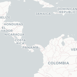
Route map (3 destinations)

Leaflet © OpenStreetMap © CARTO

Routes

UIB → BOG9R · AT5
UIB → EOH9R · AT5
UIB → CLO9R · AT5
UIB → BOGAV · AT5
UIB → EOHAV · AT7 AT5
UIB → BOGLA · DH2
Hotels near UIB

Pick what matters for your layover or early flight, then compare on your favorite booking site.

Compare stays for your dates

AirlinesAirports may receive compensation when you book or purchase through some of the links on this page, at no additional cost to you. Prices and availability are set by the booking provider and may change. We never share your private trip details with partners — only the destination, dates and party size you searched.

City & Place Guide

Gateway to the Chocó rainforest, rivers, and Afro-Colombian culture.

Quibdó is the capital of the Chocó department in western Colombia, situated along the Atrato River — one of the most biodiverse regions on Earth. The city serves as a cultural and commercial hub for the surrounding rainforest communities, offering visitors an authentic and largely off-the-beaten-path experience far from typical tourist circuits.

The city is known for its vibrant Afro-Colombian heritage, expressed through music, festivals, and gastronomy. The annual Fiestas de San Pacho, a UNESCO-recognized carnival held in September and October, draws visitors with colorful street processions, traditional music, and community celebrations. Quibdó is also a practical base for exploring nearby rivers, waterfalls, and the stunning Pacific coast beaches around Nuquí and Bahía Solano.

  • •Fiestas de San Pacho — UNESCO-listed carnival celebrating Afro-Colombian identity with music and parades.
  • •Atrato River — one of Colombia's mightiest rivers, ideal for boat rides and local life.
  • •Cathedral of San Francisco de Asís — central colonial-era church anchoring the city's historic core.
  • •Nuquí & Bahía Solano — nearby Pacific coast villages reached by small plane, famous for whale watching.
  • •Río Quito — jungle river corridor offering gold-panning villages and pristine nature.
  • •Mercado Central — lively market showcasing tropical fruits, river fish, and local crafts.

Getting around: Quibdó has no urban rail; getting around the city relies on motorcycle taxis (mototaxis), shared tuk-tuks, and traditional taxis, all of which are affordable and widely available. Long-distance travel within Chocó depends on riverboats along the Atrato and small regional aircraft, as road infrastructure remains limited. Rideshare apps are not reliably available here.

Best time: The drier relative calm of December through March offers slightly better travel conditions, though Quibdó is one of the rainiest cities in the world and rain can occur at any time of year.

Local food: Try tapao de pescado (river fish stew with plantain), aborrajados (fried sweet plantain stuffed with cheese), and fresh juices made from exotic Chocó fruits like borojó and chontaduro.

This guide is provided for general information only. Verify details locally before making travel decisions.

Passport, Visa & Immigration

Flying internationally via UIB? Check entry, transit and customs requirements for Colombia from official government sources.

El Caraño Airport
Encyclopaedia

El Caraño Airport is an airport serving Quibdó in the Chocó Department of Colombia. In 2016, the airport handled 368,920 passengers, and 347,208 in 2017.

Read full article on Wikipedia

Latest news

Entity data from open aviation datasets (OurAirports, OpenFlights) with AI-assisted editorial clearly marked. Always confirm time-sensitive details with the official airport website. Sources & verification