Overview
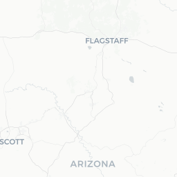
Flagstaff sits at roughly 7,000 feet (2,130 m) elevation in northern Arizona, surrounded by the largest contiguous ponderosa pine forest in North America. Its cooler temperatures make it a striking contrast to the desert cities to the south, and its central location places it within easy reach of some of the American Southwest's most significant natural and cultural landmarks.
The city has a compact, walkable downtown anchored by a stretch of Historic Route 66 and a lively arts and craft beer scene rooted partly in Northern Arizona University (NAU). It has also earned International Dark Sky City designation from the International Dark-Sky Association, making it a serious destination for amateur astronomers and stargazers.
Flagstaff's identity is shaped by its layered history: Indigenous peoples—including the Navajo Nation and Hopi Tribe—have deep ties to this region, followed by railroad expansion in the late 19th century that transformed the settlement into a commercial hub. That railroad heritage is still visible in the historic downtown depot and brick storefronts along the main corridor.
Before You Go
Visas and Entry
Flagstaff is in the continental United States. For visa and entry requirements, check TravelerPulse's Visas section and the official US Customs and Border Protection website, as rules vary significantly by nationality.
Climate and What to Pack
Because of its elevation, Flagstaff is considerably cooler than the rest of Arizona year-round. Summer highs typically reach the mid-70s°F (low-to-mid 20s°C), while winter temperatures regularly drop below freezing and snowfall is common. Afternoon thunderstorms are frequent from July through September (monsoon season). Pack layers in any season, and waterproof footwear is advisable in winter or during monsoon months.
Altitude
At approximately 7,000 feet, some visitors—particularly those arriving from sea level—may experience mild altitude-related symptoms such as headaches, fatigue, or shortness of breath during the first day or two. Staying hydrated and avoiding strenuous activity immediately upon arrival can help with acclimatization.
Practical Timing Notes
- Grand Canyon South Rim (about 80 miles north) is extremely busy from late May through August; book accommodation and shuttle reservations well in advance.
- Arizona Snowbowl ski area typically operates late November through early April, conditions permitting; verify the current season's status on their official site.
- Northern Arizona University's academic calendar affects hotel availability and pricing around graduation, move-in weekends, and home football games.
Getting There
By Air
Flagstaff Pulliam Airport (FLG) offers limited scheduled service. Most travelers fly into Phoenix Sky Harbor International Airport (PHX), roughly 150 miles south, and drive or take a shuttle north on Interstate 17. Verify current shuttle operators and schedules locally, as service providers change.
By Car
Flagstaff is located at the intersection of Interstate 40 (east-west) and Interstate 17 (south to Phoenix), making it straightforward to reach by road. Driving from Phoenix takes approximately 2 to 2.5 hours under normal conditions. The route along I-17 includes significant elevation gain; take standard precautions in winter when the highway may require chains or snow tires, and check the Arizona DOT road conditions site before traveling.
By Train
Amtrak's Southwest Chief line stops at Flagstaff's historic downtown station, connecting the city to Los Angeles, Albuquerque, Kansas City, and Chicago. The station is within walking distance of downtown accommodations and restaurants. Verify current schedules and booking on Amtrak's official site.
By Bus
Long-distance bus services connect Flagstaff to Phoenix, Albuquerque, and other regional cities. Verify current operators and schedules locally.
Getting Around
Downtown Flagstaff is compact and walkable; most restaurants, shops, and cultural venues along Route 66 and in the Southside neighborhood are accessible on foot from centrally located accommodation.
For trips beyond downtown—including NAU's campus, the Arizona Snowbowl, or trailheads—a rental car is the most practical option. Mountain Line Transit operates local bus routes throughout the city; verify current routes and fares on their official site.
Rideshare apps operate in Flagstaff, though coverage is less consistent than in larger metro areas. Many visitors use a combination of walking downtown and driving for outlying attractions. Bicycling is popular locally; a network of trails and lanes connects several neighborhoods, and rental options are available—verify current providers locally.
Note that a car is essential for day trips to the Grand Canyon South Rim, Sedona, Monument Valley, or other regional sites, unless you book an organized tour.
Where to Stay
Flagstaff's accommodation ranges from historic downtown hotels and independent boutique properties to national chain hotels clustered along the interstate corridors, as well as vacation rentals and campgrounds in the surrounding national forest.
General Areas
- Downtown / Historic Route 66 — Staying here puts you within walking distance of restaurants, the train station, and cultural venues. Properties in this area tend to book up quickly during peak season and university events.
- East / West I-40 corridors — Chain hotels here offer more predictable pricing and availability, with the trade-off of needing a car to reach most attractions.
- National Forest campgrounds — Coconino National Forest surrounds the city and offers numerous campgrounds. Conditions and availability vary by season; reserve through Recreation.gov where applicable and verify current fire restrictions, which can affect camping.
Book as far in advance as practical if visiting in summer, during ski season weekends, or around university events. Prices fluctuate considerably with demand; verify current rates directly with properties or through booking platforms.
Things to See & Do
Natural Landscapes
- San Francisco Peaks — The volcanic mountain range just north of the city includes Humphreys Peak, the highest point in Arizona at 12,633 feet (3,851 m). Hiking trails range from moderate forest walks to a strenuous summit route. The Peaks hold deep spiritual significance for multiple Indigenous nations, including the Navajo and Hopi—treat the area with corresponding respect.
- Walnut Canyon National Monument — Ancient cliff dwellings built by the Sinagua people are accessible via a short but steep loop trail. Managed by the National Park Service; verify current fees and hours on the NPS official site.
- Sunset Crater Volcano and Wupatki National Monuments — A scenic loop road northeast of the city passes a relatively young volcanic cinder cone and well-preserved ancestral Puebloan ruins. Managed by NPS; verify fees and hours officially.
- Oak Creek Canyon — The dramatic canyon south toward Sedona is one of the most scenic drives in the state, with swimming holes and hiking trails along the creek.
Astronomy
- Lowell Observatory — An operational research observatory founded in 1894, where Pluto was discovered in 1930. Public programs including telescope viewing are offered most evenings; verify current schedules and ticket availability on Lowell's official site.
- The International Dark-Sky City designation means good stargazing is possible from many points within and around the city on clear nights.
History and Culture
- Historic Downtown and Route 66 — The stretch of brick storefronts, the restored train depot, and Weatherford Hotel (verify current operational status) reflect Flagstaff's railroad-era character.
- Museum of Northern Arizona — A well-regarded institution covering the natural history, archaeology, and Indigenous cultures of the Colorado Plateau. Verify current hours and admission on their official site.
- Riordan Mansion State Historic Park — A craftsman-style duplex mansion built in 1904 by two prominent local families; now a state park with guided tours. Verify hours and fees on Arizona State Parks' official site.
Food & Drink
Flagstaff has a dining scene that punches above its size, shaped in part by NAU's student population, a significant outdoor-recreation demographic, and long-standing Indigenous and Southwestern culinary traditions.
What to Expect
- Craft beer — The city has a notable concentration of craft breweries, several of which are within walking distance of downtown. This is one of Flagstaff's most consistent local distinctions.
- Southwestern and New Mexican flavors — Green chile, posole, and other regional staples appear across many local menus.
- Indigenous and Navajo-influenced cuisine — Fry bread and Navajo tacos appear at local establishments and festivals; eating these can be a culturally informed experience when purchased from Indigenous-owned vendors.
- Farm-to-table and vegetarian options — Several restaurants emphasize locally sourced ingredients, and vegetarian and vegan diners generally have reasonable choices.
Practical Notes
Restaurant hours and business status in a city this size can change; it is always worth verifying before making special trips. The Southside neighborhood and downtown corridor are the primary dining districts. Reservation practices vary by establishment—checking ahead for dinner on weekends is advisable.
Practical Information
Emergency Services
In any emergency in the United States, dial 911 for police, fire, or ambulance.
Money
Flagstaff is a standard US city for payment; credit and debit cards are widely accepted. ATMs are readily available downtown and at most commercial areas.
Connectivity
Mobile coverage from major US carriers is generally reliable in the city. Be aware that coverage drops significantly on rural roads heading toward the Navajo Nation, Monument Valley, and remote canyon areas—download offline maps before leaving town.
Accessibility
Downtown Flagstaff has some older sidewalks and historic buildings that may present accessibility challenges. Many natural sites, including some NPS-managed areas, have accessible facilities and trails; verify specific accessibility features on official site pages before visiting.
Time Zone Note
Arizona observes Mountain Standard Time year-round and does not switch to Daylight Saving Time. However, the Navajo Nation (which you may pass through on a day trip) does observe Daylight Saving Time. This can create scheduling confusion in spring and summer—double-check times when crossing into Navajo land.
Safety
Flagstaff is generally considered a safe destination for travelers. Standard urban precautions apply downtown, particularly at night around bars and transit areas.
Outdoor Safety
The biggest risks in the Flagstaff area are environmental. Altitude, extreme weather, and remote terrain require preparation:
- Flash floods are a real hazard during monsoon season (July–September), especially in canyons. Check weather forecasts and never enter a slot canyon or low-water crossing if storms are present or possible upstream.
- Wildlife — Black bears and mountain lions are present in the surrounding forest; follow Leave No Trace practices and proper food storage protocols when camping.
- Winter driving — Roads into the mountains and toward the Grand Canyon can become dangerous quickly during snowstorms. Carry chains or ensure your rental vehicle has appropriate tires; check ADOT road conditions before departure.
- Sun and dehydration — Even at altitude, UV exposure is significant. Carry sufficient water on any hike; the rule of thumb in the Southwest is to bring more than you think you need.
Always inform someone of your hiking plans and expected return time when venturing into remote areas.
Local Culture & Etiquette
Flagstaff occupies land within the traditional territories of multiple Indigenous peoples, including the Navajo (Diné), Hopi, Havasupai, Hualapai, Apache, and Zuni nations, among others. The Museum of Northern Arizona and Wupatki National Monument offer substantive context for understanding the deep history of the Colorado Plateau's Indigenous cultures.
When visiting Indigenous lands or purchasing Indigenous art and crafts, buy directly from Native artisans where possible, and look for authentication such as the Indian Arts and Crafts Act label. Avoid purchasing items falsely marketed as Native-made.
NAU gives the city an active cultural calendar—music, theater, lectures, and sporting events are regular features. The university also contributes to a notably progressive and environmentally conscious local culture relative to much of the surrounding region.
Flagstaff's railroad and Route 66 heritage is part of a broader American mythology, but the city is equally defined by its scientific institutions (Lowell Observatory, USGS Astrogeology Science Center, and NAU's research programs) and its outdoor recreation identity. The combination gives it a character distinct from other Arizona cities.