Overview
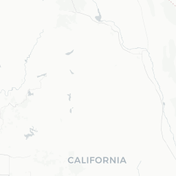
Fresno sits near the geographic center of California, in the broad, flat San Joaquin Valley flanked by the Sierra Nevada to the east and the Coast Ranges to the west. With a population of roughly 540,000 it is the fifth-largest city in California and the largest inland city in the state. It functions as the commercial and agricultural hub of one of the most productive farming regions in the world, contributing a significant share of the nation's fruits, nuts, and vegetables.
For travelers, Fresno's chief appeal is its location. Yosemite, Kings Canyon, and Sequoia national parks are all within roughly 60–100 miles of the city center, making Fresno the most practical overnight base for visiting all three. The city itself offers a handful of genuinely distinctive attractions—most notably the subterranean Forestiere Underground Gardens—alongside a diverse food scene shaped by Armenian, Hmong, Mexican, Punjabi, and other immigrant communities that have settled here over generations.
Fresno's climate is semi-arid Mediterranean. Summers are long and intensely hot, routinely exceeding 100 °F (38 °C), while winters are mild but can bring dense tule fog that significantly reduces visibility across the valley. Spring and autumn offer the most comfortable conditions both in the city and in the mountain parks nearby.
Before You Go
Visas
Fresno is a US domestic destination. International travelers should check TravelerPulse's Visas section and the official US Customs and Border Protection website for entry requirements relevant to their nationality.
Climate and packing
- Summer (June–September): Temperatures frequently reach 100–110 °F (38–43 °C). Pack lightweight, breathable clothing, sunscreen, and a reusable water bottle. Hydration is a genuine health concern.
- Winter (December–February): Valley lows can dip into the 30s °F (around 1–4 °C) and dense tule fog may persist for days. Pack layers and allow extra time when driving.
- Spring/Autumn: Light layers work well; evenings cool quickly. If heading into the mountains, pack warmer clothing regardless of valley temperatures.
Park reservations
Yosemite National Park requires timed-entry reservations during peak season (typically late spring through early autumn). Book well in advance through Recreation.gov. Kings Canyon and Sequoia have their own permit and reservation requirements; verify current conditions on the National Park Service website before your trip.
Health
Air quality in the San Joaquin Valley can be poor, particularly in summer and autumn. Fresno regularly records some of the worst air quality readings in the US. Travelers with asthma, allergies, or respiratory conditions should monitor the AirNow.gov forecast and limit outdoor exertion on high-pollution days.
Getting There
By air
Fresno Yosemite International Airport (FAT) is located a few miles north of downtown and handles direct or one-stop service from major West Coast hubs and several other US cities. Verify current routes and schedules with individual airlines, as service changes frequently.
By car
Fresno lies on Highway 99, the main spine of the Central Valley. It is approximately 185 miles (3 hours) south of Sacramento, 220 miles (3.5 hours) southeast of San Francisco, and 220 miles (3–3.5 hours) north of Los Angeles. Interstate 180 and State Route 41 connect the city to the national parks to the east. A personal vehicle is strongly recommended for exploring the region.
By rail and bus
Amtrak's San Joaquin line stops in Fresno with service connecting to Oakland/Emeryville and Bakersfield, where connecting buses link south toward Los Angeles. Greyhound and Flixbus also serve the city. Verify current schedules and booking on the respective operator websites.
Getting Around
Fresno is a car-dependent city and a personal vehicle is the most practical way to get around, especially for reaching the national parks. Street parking is generally available outside the downtown core, and most attractions have free or low-cost parking lots.
Fresno Area Express (FAX) operates the city bus network. Service covers major corridors but frequencies can be low and schedules may not align well with tourist itineraries. Verify current routes and fares on the Fresno County Department of Public Works and Planning website.
Ride-hailing services (Uber and Lyft) are available throughout the city and are a viable option for trips within central Fresno. However, they are not a practical way to reach the national parks—distances are long and costs would be prohibitive.
If you plan to visit Yosemite specifically, YARTS (Yosemite Area Regional Transportation System) operates seasonal bus service from Fresno to Yosemite Valley. Check the YARTS website for current seasonal schedules and fares before traveling.
Where to Stay
Fresno has a full range of chain hotel options at most price points, concentrated near the airport on North Blackstone Avenue, around the Shaw Avenue corridor, and near downtown. Budget, mid-range, and full-service properties from major US brands are all represented; verify current availability and pricing on standard booking platforms.
For visitors whose primary purpose is national park access, note that lodging within Yosemite, Sequoia, and Kings Canyon fills months in advance during peak season. If in-park accommodation is not available, Fresno is the largest city offering a wide range of options at lower prices than gateway towns like Mariposa or Three Rivers. Factor in the 60–100-mile drive to the park entrances when planning your day.
Short-term rental platforms (Airbnb, Vrbo) have listings throughout the city and surrounding suburbs. Read reviews carefully and verify the property's actual location relative to your planned activities, as Fresno and its suburbs cover a wide area.
Things to See & Do
Forestiere Underground Gardens
Baldasare Forestiere, a Sicilian immigrant, spent roughly 40 years hand-excavating a network of underground rooms, courtyards, and passages beneath his Fresno property in the early 20th century. The result is a genuinely remarkable site—cool, quiet, and filled with living citrus trees that bear fruit underground. Guided tours are required; verify opening days, hours, and admission fees on the official site before visiting as availability is limited.
Chaffee Zoo
Located in Roeding Park, the Chaffee Zoo is a well-regarded mid-sized zoo with a variety of animal exhibits including African savanna species, sea lions, and a splash zone. Verify current admission prices and hours on the zoo's official website.
Fresno Art Museum
Situated in Radio Park, the Fresno Art Museum presents rotating exhibitions of contemporary and modern art alongside its permanent collection, with a focus on works by California and Mexican artists. Check the museum website for current exhibitions and hours.
Shinzen Friendship Garden
This Japanese garden within Woodward Park was developed as a symbol of Fresno's sister-city relationship with Kochi, Japan. It is a calm, well-maintained space suitable for a quiet walk. Verify entry fees and seasonal hours locally.
Meux Home Museum
A restored Victorian-era home from the 1880s offering a glimpse into Fresno's early history. Guided tours are typically required; confirm availability locally.
Gateway to the Sierra Nevada
- Yosemite National Park (~60 miles north via Hwy 41): El Capitan, Half Dome, Yosemite Valley, and Mariposa Grove.
- Kings Canyon National Park (~85 miles east): dramatic canyon scenery and the Grant Grove of giant sequoias.
- Sequoia National Park (~75 miles southeast): home to General Sherman, the world's largest tree by volume.
All three parks require entrance fees and, at peak times, advance reservations. Confirm requirements on nps.gov.
Food & Drink
Fresno's dining scene reflects its demographics honestly rather than following national food trends. The city has long-established Armenian, Hmong, Mexican, and Southeast Asian communities, and eating in neighborhoods where those communities are concentrated tends to produce some of the most authentic and affordable meals in the region.
What to look for
- Armenian cuisine: Fresno has one of the largest Armenian-American populations in the United States. Look for lahmajoun (Armenian flatbread pizza), manti (small dumplings), and dolma at bakeries and restaurants concentrated in the Tower District and nearby neighborhoods.
- Hmong food: The Hmong community is among the largest outside Southeast Asia. Farmers markets—particularly the Hmong-operated weekend markets—are good places to find fresh produce, prepared foods, and papaya salad.
- Mexican and Central American: Taquerias and loncheras (food trucks) are spread throughout the city, with a concentration in southwest Fresno. Fresh-made tortillas, birria, and menudo are common and dependable.
- Farm-to-table and produce: Given the surrounding agricultural production, seasonal fruits and vegetables are abundant and exceptional in quality. Summer stone fruit (peaches, nectarines, plums), winter citrus, and almonds are local staples.
Tower District
The Tower District, centered on Olive Avenue near the historic Tower Theatre, is Fresno's most walkable dining and bar neighborhood, with a mix of independent restaurants, coffee shops, and live music venues.
Shopping
Shopping in Fresno is primarily practical and suburban, with large malls and strip centers rather than a concentrated boutique district. Fashion Fair Mall is the main enclosed shopping center. The Tower District has independent shops, vintage stores, and local boutiques worth browsing.
The most distinctive shopping experiences tend to be at farmers markets. The Fresno Certified Farmers Market and the Hmong Farmers Markets (check current locations and days locally) offer fresh produce, artisan goods, and prepared foods unavailable in standard retail. Dates, pistachios, dried fruit, and olive oil from local producers make practical and high-quality souvenirs.
Practical Information
Emergency services
In any emergency in the United States, dial 911 for police, fire, or ambulance.
Tipping
Tipping is standard practice in the US. The customary range is 18–20% at sit-down restaurants, around 15% for taxis, and $1–2 per drink at bars. Tipping is at your discretion at counter-service and fast-casual establishments.
Connectivity
Cell coverage from major US carriers is reliable in the city. Be aware that coverage drops significantly once you enter canyon areas of the national parks—download offline maps before leaving Fresno.
Driving notes
The San Joaquin Valley is subject to dense tule fog from roughly December through February. Fog can reduce visibility to near zero with little warning. If fog is forecast, drive with low beams on, reduce speed significantly, and consider delaying travel. Highway 99 sees a disproportionate number of fog-related accidents each winter.
Money
ATMs are widely available. Credit and debit cards are accepted almost universally. Cash is useful at farmers markets, food trucks, and some smaller establishments.
Safety
Fresno has historically had above-average property crime rates compared to California and national averages. As in any city, exercise standard precautions: do not leave valuables visible in parked vehicles, be aware of your surroundings after dark, and stick to well-trafficked areas in the evening.
The downtown core and Tower District see regular foot traffic and are generally active in the evening. Some neighborhoods in southwest and southeast Fresno have higher crime rates; if you are unfamiliar with the city, consult current local guidance or check the Fresno Police Department's public crime data.
Summer heat is a genuine safety concern. Temperatures above 105 °F (41 °C) are not unusual in July and August. Stay hydrated, avoid extended outdoor activity during peak afternoon heat (roughly noon to 5 pm), and never leave children or animals in parked vehicles.
When hiking in the national parks, register your itinerary, carry enough water (at least 2–4 liters per person per day in summer), and check trail conditions on the NPS website before setting out. Altitude sickness can affect visitors ascending quickly to higher elevations in the Sierra Nevada.