Translate


Overview
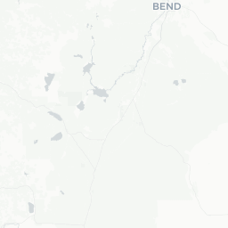
Bend sits at roughly 3,600 feet elevation on the eastern slope of the Cascades in central Oregon, straddling the Deschutes River. Once a timber town, it has grown into one of the Pacific Northwest's most popular outdoor recreation destinations, drawing visitors year-round for skiing, mountain biking, hiking, rock climbing, and whitewater paddling.
The city retains a walkable, compact downtown along with a lively arts and dining scene. The surrounding high desert—juniper flats, volcanic formations, and rimrock canyon walls—gives Bend a distinctive landscape that sets it apart from the wetter, forested parts of Oregon to the west.
Bend's population has grown substantially over the past two decades, and infrastructure has expanded accordingly. Despite that growth, the outdoors remain central to daily life here, and most visitors find the transition between urban amenities and wilderness trailheads refreshingly quick.
Before You Go
Visas and Entry
Bend is a domestic US destination. International travelers entering the United States should check TravelerPulse's Visas section and consult the US Customs and Border Protection website for current entry requirements applicable to their nationality.
Weather and Seasons
Bend receives approximately 300 days of sunshine per year and sits in a rain shadow east of the Cascades. Summers are warm and dry, with daytime highs typically in the upper 70s to mid-90s°F (25–35°C) and cool nights. Winters bring snow to higher elevations and occasional freezing temperatures in town. Spring and autumn are pleasant but can be unpredictable—pack layers.
What to Pack
- Sun protection is essential year-round; UV exposure is high at elevation
- Layered clothing for variable temperatures, even in summer
- Sturdy footwear if you plan to hike volcanic terrain (sharp lava rock is common)
- Bear awareness and Leave No Trace basics if heading into the backcountry
Altitude and Health
At roughly 3,600 feet, Bend is not extreme altitude, but visitors coming from sea level may notice mild fatigue the first day or two. Stay well hydrated, especially in the dry desert air.
Getting There
By Air
Roberts Field – Redmond Municipal Airport (RDM) is the closest commercial airport, located about 16 miles north of downtown Bend. Several major US carriers operate routes here; verify current routes and schedules on the airport's official site or with individual airlines. Portland International Airport (PDX) is a larger hub approximately 160 miles northwest, accessible by car in roughly 3 hours depending on conditions.
By Car
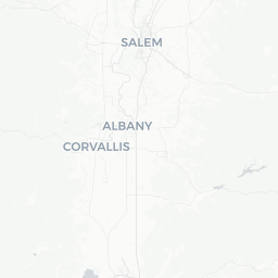
Driving is the most common way to reach Bend. US-97 runs north–south through the region, connecting Bend to the Portland metro area via US-26 or OR-22 over the Cascades. From the south, US-97 links to Klamath Falls and eventually Northern California. Mountain passes can close or require chains in winter; check Oregon Department of Transportation (TripCheck.com) for current road conditions before traveling.
By Bus
Cascades East Transit and some regional coach services connect Bend to nearby communities and, on select routes, to larger Oregon cities. Verify schedules and booking directly with carriers, as service can change seasonally.
Getting Around
Car and Rental
Having a car is strongly recommended in Bend. Most natural attractions, trailheads, and ski areas require driving, and public transit does not reach them. Car rental agencies operate at RDM airport and in town; book in advance during peak summer and ski seasons.
Cycling
Downtown Bend and the Deschutes River Trail are accessible by bicycle. The city has invested in bike infrastructure, and many locals commute by bike. Rentals are available from several shops; verify availability and current pricing locally.
Public Transit
Cascades East Transit (CET) operates fixed bus routes within Bend and to surrounding communities. Routes and fares should be confirmed on CET's official website, as schedules change. The transit system is practical for some in-town trips but is not designed for accessing most outdoor recreation areas.
Ride-Share
Ride-share services operate in Bend; availability can be limited late at night or during large events. Taxi services also exist—verify locally.
Things to See & Do
Mt. Bachelor
Mt. Bachelor Ski Area, about 22 miles southwest of downtown, is one of the largest ski resorts in the US by acreage. It operates lifts for alpine skiing and snowboarding in winter and offers mountain biking and scenic chairlift rides in summer. Verify current lift operations, pricing, and seasonal hours on the Mt. Bachelor official site before your visit.
The Deschutes River
The Deschutes River runs through downtown Bend and offers kayaking, paddleboarding, and inner-tubing (the float from Farewell Bend Park to Drake Park is popular in summer). Whitewater sections exist north of town for more experienced paddlers. Rental outfitters operate seasonally—confirm availability locally.
Smith Rock State Park
Smith Rock, about 25 miles north of Bend near Terrebonne, is one of the premier rock climbing destinations in North America and a landmark for hikers as well. The Misery Ridge Loop is a well-known trail with views of the Crooked River canyon and dramatic tuff and basalt formations. An Oregon State Parks day-use fee applies; verify current fees and reservation requirements on the Oregon State Parks website.
Newberry National Volcanic Monument
Managed by the US Forest Service, Newberry Volcanic Monument encompasses Paulina Lake, East Lake, the Lava Cast Forest, and one of the largest obsidian flows in the United States. It lies roughly 20–30 miles south of Bend. Check the Deschutes National Forest website for access, fees, and seasonal road closures.
Tumalo Falls and Local Trails
Tumalo Falls, a roughly 97-foot waterfall accessible via a short hike about 12 miles west of downtown, is a popular half-day outing. The surrounding Deschutes National Forest trail network is extensive—Bend has been recognized as a hub for cross-country mountain biking, with trail systems like Phil's Trail Complex close to town.
Downtown and Arts
Downtown Bend's Wall Street and Bond Street corridors are home to independent shops, galleries, and restaurants. The High Desert Museum, located south of downtown on US-97, covers natural and cultural history of the Intermountain West and is suitable for all ages. Verify current hours and admission on the museum's official site.
Food & Drink
Craft Beer
Bend has one of the highest concentrations of craft breweries per capita of any US city. The Bend Ale Trail is a self-guided tour of participating breweries; a passport-style card is available at participating locations and the visitor center. Deschutes Brewery, one of the oldest and largest craft breweries in the Pacific Northwest, originated here and operates a public house downtown as well as its main production facility. Many smaller taprooms are scattered throughout the city and westside neighborhoods.
Dining
The restaurant scene reflects the city's outdoor-oriented, relatively young demographic: expect farm-to-table options, wood-fired cuisine, globally influenced casual dining, and strong brunch culture. Many spots focus on locally sourced ingredients from central Oregon farms and ranches. Reservations are advisable at popular restaurants on weekends and during peak summer season.
Coffee
Bend supports a competitive independent coffee scene alongside national chains. Several local roasters operate cafés throughout the city.
Practical Notes
- Oregon has no sales tax, so menu prices are what you pay (plus tip)
- Tipping 18–20% is standard at sit-down restaurants
- Alcohol is sold at licensed establishments and some grocery stores; Oregon has no state-run liquor store monopoly for beer and wine, though spirits are sold at OLCC-licensed locations
Shopping
Downtown Bend's core offers a mix of outdoor gear retailers, independent clothing boutiques, art galleries, and home goods shops. Several well-established outdoor brands—both national and regional—have a presence here, catering to the hiking, climbing, and skiing community.
Old Mill District, a redeveloped former sawmill site along the Deschutes River southwest of downtown, houses a mix of national retailers, restaurants, and a cinema in an open-air format. It is also a venue for outdoor concerts and events in summer.
Because Oregon has no state sales tax, purchases are free of that added cost, which can make larger items like outdoor gear somewhat more affordable than in neighboring states.
Practical Information
Emergency Services
For all emergencies in the United States, dial 911. St. Charles Medical Center is Bend's primary hospital, located on Neff Road; verify its current address and services on the St. Charles Health System website.
Connectivity
Cell coverage is reliable throughout downtown Bend and most developed areas. Coverage can be poor or absent in remote wilderness, volcanic monument backcountry, and some canyon areas. Download offline maps before heading into the backcountry.
Oregon Recreation Passes and Fees
Many federal and state lands around Bend require day-use fees or passes. The America the Beautiful (Interagency) Pass covers entrance fees at most federal sites and is worth considering for a multi-site trip. Oregon State Parks have separate fee structures. Verify current requirements on relevant agency websites.
Wildfire and Air Quality
Central Oregon experiences wildfire season typically July through September. Smoke can significantly affect air quality and visibility, and trail or road closures may occur on short notice. Check AirNow.gov for air quality index and InciWeb or the Oregon Department of Forestry site for fire information before outdoor activities during this period.
Safety
Bend is generally considered a safe city for travelers. Standard urban precautions apply downtown, particularly around transit areas at night.
Outdoor Safety
The greatest safety considerations in the Bend area are outdoor and environmental. Hiking volcanic terrain involves sharp lava rock that can puncture footwear and cause falls; trail descriptions can be misleading about difficulty. Always carry more water than you think you need—the high desert is drier than it appears, and heat exhaustion is a real risk in summer.
Conditions at Mt. Bachelor and in the Cascades backcountry can change rapidly. Check avalanche forecasts from the Northwest Avalanche Center before any winter backcountry travel. Wildlife in the area includes black bears, rattlesnakes (at lower desert elevations), and cougars—learn basic wildlife encounter protocols before heading out.
Do not rely solely on GPS or cell service for navigation in remote areas. Carry a paper map or downloaded offline map, and inform someone of your plans and expected return time.